
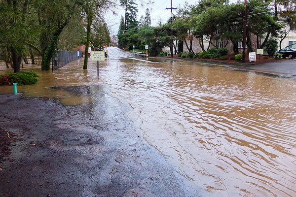
Scientists who combined an on-the-ground look at stream gauge data and an above-the-ground view from satellites have determined that as the Earth warms, the threat of flooding is growing in the northern half of the United States.
The research from the University of Iowa, published recently in the journal Geophysical Research Letters, found that shifting rainfall patterns and the amount of water in the ground are likely causes for the changes.
The work fed off research published in 2015 that looked at stream gauges in the central United States, said Gabriele Villarini, an associate professor in civil and environmental engineering at the university and a co-author of the new paper with Louise Slater. His earlier research showed limited evidence of significant changes in the magnitude of floods, but strong evidence pointing toward an increasing frequency of flooding.
On supporting science journalism
If you're enjoying this article, consider supporting our award-winning journalism by subscribing. By purchasing a subscription you are helping to ensure the future of impactful stories about the discoveries and ideas shaping our world today.
“Now that we have detected the changes, can we try to identify what the potential major drivers of these changes were?” he said. “That’s why we looked at overall wetness and precipitation as a way of trying to explain this spatially distinct patterns that we saw from the data.”
Their research also found that the South and West are experiencing decreasing flood risk, an unsurprising finding, he said, given that those regions have experienced both recent and long-standing drought, and that there is less water stored underground.
Their findings, which also aim to shift how flood risks are communicated, could have fundamental implications for water managers, agricultural interests and the people who live in flood-prone regions.
Flood risk trends are usually communicated using streamflow, such as how many feet above a certain level a river might crest. Villarini said they think that their research will help better communicate changing flood patterns to a wider audience, compared with more traditional methods of looking at flood risk.
“Generally, we have been looking at discharge, and so you would have a certain value, say, cubic feet per second,” he said. “The problem is that then you would have to convert that discharge value to a stage level, because that’s usually how this information is communicated.”
He and Slater used water height information gathered between 1985 and 2015 from 2,042 stream gauges operated by the U.S. Geological Survey. They compared that stream gauge data with information gathered over more than a dozen years by NASA’s Gravity Recovery and Climate Experiment satellites, which can show what’s called “basin wetness.” That’s the amount of water stored in the ground.
The on-the-ground data and the satellite data “complement each other nicely,” Villarini said.
Climate scientists know that the intensity of extreme precipitation events is on the rise because there’s more water vapor in the atmosphere caused by higher global and sea temperatures. With rising global temperatures, the 2014 National Climate Assessment predicts that many communities will see more frequent extreme precipitation events like the one that hit Baton Rouge, La., last year.
Reprinted from ClimateWire with permission from E&E News. E&E provides daily coverage of essential energy and environmental news at www.eenews.net.