
Hurricane Florence is bearing down on the U.S as a major hurricane that could inundate the coast with up to 13 feet of surging ocean water and more than two feet of rain.
Each of those flood hazards can do devastating damage on their own. But the combination of the two—a situation called compound flooding—could make floodwaters even higher, last longer and reach farther inland than anticipated.
Compound flooding is complex, so it has generally not been considered in flood forecasting and prevention planning. Now it is gaining attention among researchers and coastal emergency managers working to better understand who and what will be flooded during extreme weather events as well as how threats might change as coastal populations boom and the climate transforms. “We have ignored it in the past, we cannot ignore it in the future,” says Amir AghaKouchak, a civil engineer at the University of California, Irvine, who has studied the issue.
On supporting science journalism
If you're enjoying this article, consider supporting our award-winning journalism by subscribing. By purchasing a subscription you are helping to ensure the future of impactful stories about the discoveries and ideas shaping our world today.
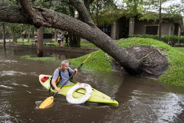
As a tropical storm reaches land, its winds pile up ocean water in front of it, pushing a surge ashore. Meanwhile torrential rains can overwhelm the ground and rivers, causing floods even hundreds of miles inland. But compound flooding arises when both dynamics meet, exacerbating the overall impact. Compound flooding contributed to the unprecedented inundation of the Houston area during Hurricane Harvey. Although that storm’s record rains would have caused terrible flooding on their own, the moderate ocean surge that lingered in Galveston Bay as Harvey stalled meant floodwaters stayed high for days.
Typically, a storm surge pushes in, then washes out; heavy rain falls on the coast and inland, draining via gravity to the sea, often via rivers and streams. But if a huge storm stalls along the coast, high seas can continue to push onto land after the initial surge. That high water can stop heavy rain from draining. Water rises everywhere and can stay that way for days. As a result, people can be trapped with no direction to escape, possibly without power or food—as they were during Harvey, necessitating widespread search and rescue operations. “That’s just a completely different impact than we’ve traditionally prepared for,” says Antonia Sebastian, an associate research scientist at Texas A&M University at Galveston, who studied the event. The entire Southeast coast is a hotspot for this type of flooding, in part because it is prone to being hit by tropical systems, according to a 2015 study spearheaded by Thomas Wahl, a civil engineer at the University of Central Florida.
A similar situation could play out with Florence, which is expected to stall once it makes landfall, sandwiched in by two atmospheric high-pressure systems, as happened with Harvey. As Florence lingers, it will continue to push surge ashore and rains will pile up. Forecasts indicate up to 30 inches of rain, with some isolated spots possibly reaching 40 inches. Areas at particular risk from compound flooding are those near some of the major river watersheds, including the Tar-Pamlico and Neuse basins, both of which empty into Pamlico Sound, says Jessica Whitehead, a hazards adaptation strategist with the North Carolina Sea Grant.
Surge strength and local geography can change the likelihood and location of compound flooding. Higher surge pushes farther inland, increasing the area that could be subject to compound flooding. Topography that tends to drain water away quickly also increases the odds of rainwater flood and surge coinciding, Sebastian says. “When you start to zoom into the coastline, there are these really complex features.” When determining where compound flooding is likely to happen, “you begin to face these challenges of every coastline behaving differently.”
Researchers like Sebastian, AghaKouchak and Wahl are working to make these risks clearer so they can be incorporated into coastal communities’ flood protection planning. Wahl is working with both the Army Corps of Engineers and the South Florida Water Management District to see if the flood levels they plan for would change when compound flooding is factored in. The level of a 100-year flood could be much higher, in which case “we may have to adjust our flood zones,” Wahl says. Where flood protection infrastructure is placed and how it is designed could change as well. Wahl is also resubmitting a proposal to study compound flooding in Jacksonville; it had been rejected two weeks before such flooding during Hurricane Irma damaged the Florida city. Prior to Irma, “people were saying, ‘that’s not really a research priority,’” he says.
Sebastian is examining how warming might change the atmospheric patterns that contribute to storms stalling and “where and to what extent is that going to exacerbate compound flooding,” she says. AghaKouchak is studying how sea level rise might affect such flooding; a 2017 study he co-authored found that when compound flooding and sea level rise were factored in, the chances of floods that exceed what local infrastructure was built to accommodate went up considerably.
Understanding compound flooding requires advanced computer models and complex statistics. It will take time for scientists to fully understand the evolving risks. The aim, though, is to one day have forecast maps like those that already exist separately for rainfall and storm surge, and which would show where compound flooding is likely to crop up during a storm. “That has to be the goal,” Wahl says.
