
Scientists working to improve storm intensity forecasting have identified a more accurate means of predicting a hurricane’s strength as it approaches landfall, using sea temperature readings that they say will help forecasters better prepare communities for storm impacts in the face of sea-level rise caused by rising global temperatures.
Their research, published yesterday in Nature Communications, helped identify why 2011’s Hurricane Irene and 10 other summer hurricanes in the Mid-Atlantic failed to intensify as predicted.
The researchers, led by Scott Glenn of the Center for Ocean Observing Leadership at Rutgers University in New Jersey, focused on the small shifts in sea temperature prior to Irene. They identified wind patterns that mixed the warmer surface and colder deep waters to cool the ocean’s surface and reduce the intensity of the storm.
On supporting science journalism
If you're enjoying this article, consider supporting our award-winning journalism by subscribing. By purchasing a subscription you are helping to ensure the future of impactful stories about the discoveries and ideas shaping our world today.
The team also identified similar patterns of ocean physics in the Yellow Sea of the Pacific Ocean during Typhoon Muifa, which also weakened.
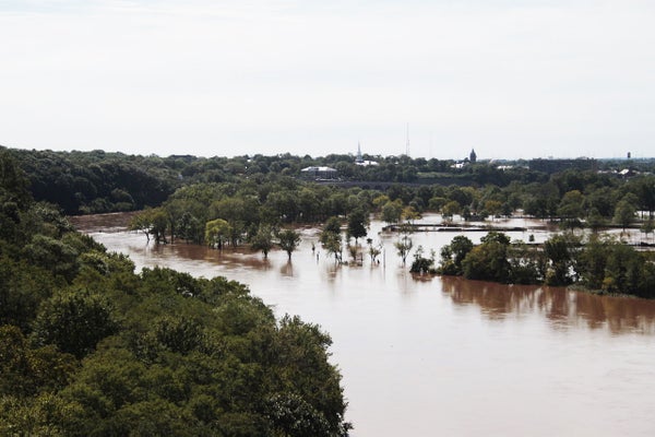
Those same colder waters weren’t present in Superstorm Sandy, which occurred later in the hurricane season in 2012, the researchers noted. But as climate patterns become less predictable and global ocean temperatures rise, the water temperature readings identified by the Rutgers team might bring to light similar patterns that will allow forecasters to adjust their intensity forecasts accordingly.
Previous studies have zeroed in on the effect in the deep ocean, the study said, but not as close to shore. The information they’ve unearthed about intense sea surface cooling is crucial as sea levels rise, the researchers said.
“If there’s missing pieces to those forecasts based on unknown physics of the ocean, you can’t make good decisions,” said Travis Miles, one of the researchers.
Did Irene’s ‘overprediction’ spur Sandy losses?
Over the past two decades, forecasters have improved their ability to predict where hurricanes will go, but improvements in forecasting a hurricane’s intensity have proved elusive. Enhancing hurricane intensity forecasts is a powerful motivator for many hurricane researchers, said Glenn, the lead author of the paper.
The Rutgers team also had a motivating push, albeit indirectly, from New Jersey Gov. Chris Christie (R), who in 2011 closed the Atlantic City casinos and warned vacationers to “get the hell off the beach” before Irene.
“Everybody said ‘get away from the beach,’” Glenn said.
Although Irene proved to be the eighth most costly cyclone to hit the United States since 1900, “nothing happened on the beach,” he said. A year later, though, Sandy hit.
The “severe overprediction” during Irene had an impact on preparedness, the researchers said. Intensity forecast uncertainties have consequences and not just forcing beachgoers out of the waves early. Not only is it expensive to evacuate people unnecessarily, they note, but future public skepticism breeds complacency.
The researchers also cite previous research showing that over the past 30 years, the location where tropical cyclones reach their maximum intensity has shifted away from the equator and toward the poles. The pattern isn’t as evident in the northern Atlantic Ocean as it is in the southern Indian Ocean and the southern Pacific Ocean, but if the trend continues, it means more intense hurricanes in places of greater population.
Insurers are taking note, said Megan Linkin, a vice president with Swiss Re, who is familiar with the Rutgers research.
“If hurricane intensity increases pole-ward ... it is going to have to be addressed by governments, individuals and businesses,” she said. “We have to prepare for our worst-case event. We can’t just prepare for what we think can happen.”
Reprinted from Climatewire with permission from Environment & Energy Publishing, LLC. www.eenews.net, 202-628-6500
