
Congress is taking aim at how communities address some of the most troublesome properties that require repeated federal flood insurance payouts under the National Flood Insurance Program.
Bipartisan legislation introduced yesterday would force communities to address patterns of repeated loss—one of the leading reasons many critics of the federally backed insurance program say it’s in trouble. The bill, which is sponsored by Reps. Ed Royce (R-Calif.) and Earl Blumenauer (D-Ore.), is expected to eventually be wrapped into the reauthorization of the flood insurance program next year.
“Repetitive flood loss continues to place communities and families at risk, while shortchanging the federal taxpayer and all those who pay flood insurance premiums,” Blumenauer said.
On supporting science journalism
If you're enjoying this article, consider supporting our award-winning journalism by subscribing. By purchasing a subscription you are helping to ensure the future of impactful stories about the discoveries and ideas shaping our world today.
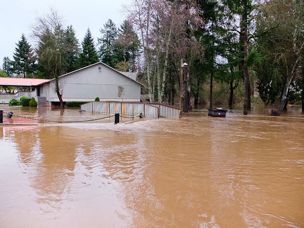
The federal flood insurance program plunged into debt after Hurricane Katrina in 2005 and, more recently, after Superstorm Sandy in 2012. Properties that flood repeatedly represent about 1 percent of the total policies in the program but add up to 25 to 30 percent of the claims. They also represent abut $12 billion of the program’s $23 billion debt, said Phyllis Cuttino, director of the flood-prepared communities initiative at the Pew Charitable Trusts.
“These are properties that file multiple claims and that are built and rebuilt again and again,” she said. “They have kind of this outsize financial impact. I think of them as kind of the sickest patients in the program. They’re the very properties that we have to do something about.”
The legislation, known as the “Repeatedly Flooded Communities Preparation Act,” requires communities with a significant number of repeatedly flooded properties to map those properties, as well as public infrastructure to determine the specific areas that get flooded often. That way, they can determine which areas should be priorities for voluntary buyouts, drainage improvements or other mitigation efforts.
It also requires communities with repeated problems to consider land-use planning and other factors that might be contributing to flooding, as well as requires them to implement plans for mitigating flood risk in troublesome areas.
Those communities would be required to submit their mitigation plans as well as progress reports to the Federal Emergency Management Agency. The agency in turn would be required to develop criteria to oversee the repeat-loss plans and determine any appropriate sanctions for communities that fail to act.
One NFIP-insured home valued at $69,000 flooded 34 times in 32 years and racked up $663,000 in claims, said Royce, the California congressman.
“It’s said that insanity is doing the same thing over and over again and expecting different results,” Royce said in a statement. “It’s time to stop the madness for policyholders and taxpayers who subsidize this cycle.”
Tom Salomone, the president of the National Association of Realtors, said the organization’s members are eager to see a broad discussion about flood insurance as Congress considers reauthorizing the program. The legislation introduced yesterday takes an approach to repeatedly flooded properties “that deserves consideration,” he said in a statement.
“As part of that process, we welcome proactive, thoughtful ideas to address the repeatedly flooded properties that make up a disproportionate share of the claims made against the program,” he said.
The House earlier this year passed legislation that could open the flood insurance market to more private firms, a move backed by the NAR.
Congress may also begin looking at the accuracy of the flood maps that determine who is eligible for insurance—and who must have it, if they have a mortgage.
FEMA draws the maps that identify low-lying, flood-prone areas. Those maps do not take into account the effects of sea-level rise or climate change, however, and many in Congress are concerned about their accuracy. Flood maps also fail to take into account increasingly common extreme precipitation events, like those that swept through Louisiana this summer. With rising global temperatures, the 2014 National Climate Assessment predicts that many communities will see such extreme precipitation events more frequently.
More accurate flood maps could mean more realistic and reliable risk analysis and insurance rates. Of the estimated 143,000 homes damaged in Baton Rouge’s once-in-1,000-year flood, for example, as many as 80 percent were outside “high risk” flood zones. That left a large percentage of homeowners without insurance, although they are still eligible for as much as $33,000 in flood relief from FEMA.
This story also appears in E&E Daily.
Reprinted from ClimateWire with permission from Environment & Energy Publishing, LLC. E&E provides daily coverage of essential energy and environmental news at www.eenews.net. Click here for the original story.
