
On supporting science journalism
If you're enjoying this article, consider supporting our award-winning journalism by subscribing. By purchasing a subscription you are helping to ensure the future of impactful stories about the discoveries and ideas shaping our world today.
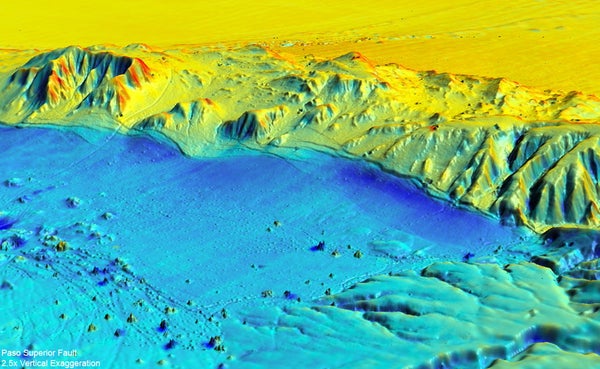
A team of geologists from the U.S., Mexico and China are using light detection and ranging (LiDAR) laser altimetry to study how an earthquake can change a landscape. In particular, the geologists want to know more about the magnitude 7.2 quake that struck April 4, 2010, near Mexicali in northern Mexico. Airborne LiDAR equipment, which bounces a stream of laser pulses off the ground, can measure surface features to within a few centimeters. The researchers were able to make a detailed scan of the affected area over about 360 square kilometers in less than three days, they report in the February 10 issue of the journal Science.
In the above image, blue shows where ground surface moved down whereas red indicates upward movement compared with the previous survey.
LiDAR has a number of applications. Researchers have used it to study the properties of Saharan dust clouds for climate models as well as to gather detailed information on the plume emanating from Iceland's Eyjafjallajökull volcano. Mexico had used LiDAR to map the Mexicali region in 2006, so Michael Oskin, a geology professor at the University of California, Davis, the paper's lead author, and his colleagues had a baseline with which to compare their results.
Some changes brought about by the quake are readily visible from the ground, such as a 1.5-meter clifflike ridge created when part of a hillside abruptly moved up and sideways. But the LiDAR survey also revealed some features that could not easily be detected otherwise, Oskin reports, such as a warping of the ground surface above the Indiviso Fault, which runs beneath agricultural fields along the Colorado River floodplain.
The 2010 Mexicali earthquake did not occur on a major fault, such as the San Andreas, but rather ran through a series of smaller fractures in Earth's crust. The new LiDAR survey shows how seven of these small faults came together to cause a major quake.
—Larry Greenemeier
