
Glaciologists will soon have a treasure trove of data for exploring how Antarctica’s underbelly has changed over nearly half a century. An international team of researchers has scanned and digitized 2 million records from pioneering aeroplane radar expeditions that criss-crossed the frozen continent in the 1960s and 1970s.
“These are the flights that invented this way of doing glaciology,” says Dustin Schroeder, a radar engineer at Stanford University in California who is leading the new project.
The digitized data extend the record of changes at the bottom of the ice sheet, such as the formation of channels as Antarctica’s ice flows, by more than two decades. “All of a sudden it allows us to understand how dynamic the bottom of the ice sheet was—or was not—over that long time period,” Schroeder says. The work could also help researchers get a better handle on how the ice sheet might respond as global temperatures rise.
On supporting science journalism
If you're enjoying this article, consider supporting our award-winning journalism by subscribing. By purchasing a subscription you are helping to ensure the future of impactful stories about the discoveries and ideas shaping our world today.
Schroeder described the findings on December 13 in New Orleans, Louisiana, at a meeting of the American Geophysical Union. The team hopes to publish a paper and get the data online, freely available through the Stanford library, in the coming months.
"Going back in time is exactly what we need to do," says Helen Fricker, a glaciologist at the Scripps Institution of Oceanography in La Jolla, California. "It's a benchmark to compare what the ice sheets were like, with now."
Hidden depths
Scientists have used old aerial surveys to chart surface changes in the Arctic and Antarctic, for example by studying photographs of Greenland’s glaciers to document their history. But peering through ice to the bedrock—which can be hundreds or thousands of metres down—requires seismic surveys or, more typically, radar.
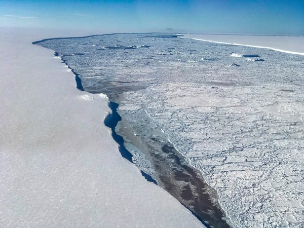
In aeroplane radar surveys, researchers fly over the ice, pinging radar signals downwards and measuring how they bounce off the interface between the ice and the bedrock. The data reveal not only the thickness of the ice, but also whether there are signs of melting such as subglacial lakes or ice accumulations where the flowing ice gets caught on a rough spot in the underlying rock.
In Antarctica, the first widespread radar mapping took place between 1967 and 1979, in a programme run by the Scott Polar Research Institute (SPRI) in Cambridge, UK; the US National Science Foundation; and Delft University of Technology in the Netherlands. Their scientists flew more than 250,000 kilometres across much of West Antarctica—including the areas draining to the Ross and Ronne ice shelves—and part of East Antarctica, including the famous ice-core-drilling sites Vostok and Dome C.
Scientists used the data to explore Antarctic ice thickness and the distribution of subglacial lakes. But the information mostly sat as rolls of 35 mm, 8 mm and Super 8 film at the SPRI library. Very little of it had been digitized until Schroeder began to wonder about it, and SPRI director Julian Dowdeswell invited him to Cambridge.
Using start-up funds for his Stanford laboratory, Schroeder started looking for experts who could handle old film. He called the Academy of Motion Picture Arts and Sciences in Hollywood, which pointed him to companies that restore film. He bought a specialized scanner, hunted down some of the vintage equipment that he needed on eBay, and flew with two art historians to Cambridge in June 2016. Over the course of 2 weeks, they carefully cut, taped and scanned about 1,000 rolls of archival film.
What lies beneath
Schroeder has already spotted fine details in the data, such as channels beneath ice shelves and accretion plumes where ice has been piling up. These features had been observed before, Schroeder says, "but now that we know we can see them, we'll look for new ones too."
Modern radar mapping of Antarctica didn’t begin in earnest until the 1990s, so pushing the data set back another two decades is a significant improvement, he says.
The 1970s data are so high-resolution that they can be used to improve bedrock-topography maps of Antarctica1. These are crucial for modellers because they test how ice sheets respond to changing temperatures.
Schroeder hopes soon to digitize similar 1970s radar data for Greenland.
This article is reproduced with permission and was first published on December 13, 2017.
