
This article was published in Scientific American’s former blog network and reflects the views of the author, not necessarily those of Scientific American
Rocky worlds with thin atmospheres expose their knobbly, crusty surfaces to the universe. Deep history as well as present status is writ large on these faces. Geophysical processes are merged with the weathering effects of atmospheres, asteroids, and biospheres to sculpt and change a planetary shell.
Although we live on one such world, we still have a challenge to see it for what it is. The European Commission and European Space Agency's Copernicus Programme is one of our ways of dealing with this. Together with a host of other Earth observing satellites, the Copernicus effort is placing a series of Sentinel missions into orbit in order to provide one of the most comprehensive views of our planetary properties and health ever achieved.
Several of the Sentinel satellites are already launched, and more are on the way.
On supporting science journalism
If you're enjoying this article, consider supporting our award-winning journalism by subscribing. By purchasing a subscription you are helping to ensure the future of impactful stories about the discoveries and ideas shaping our world today.
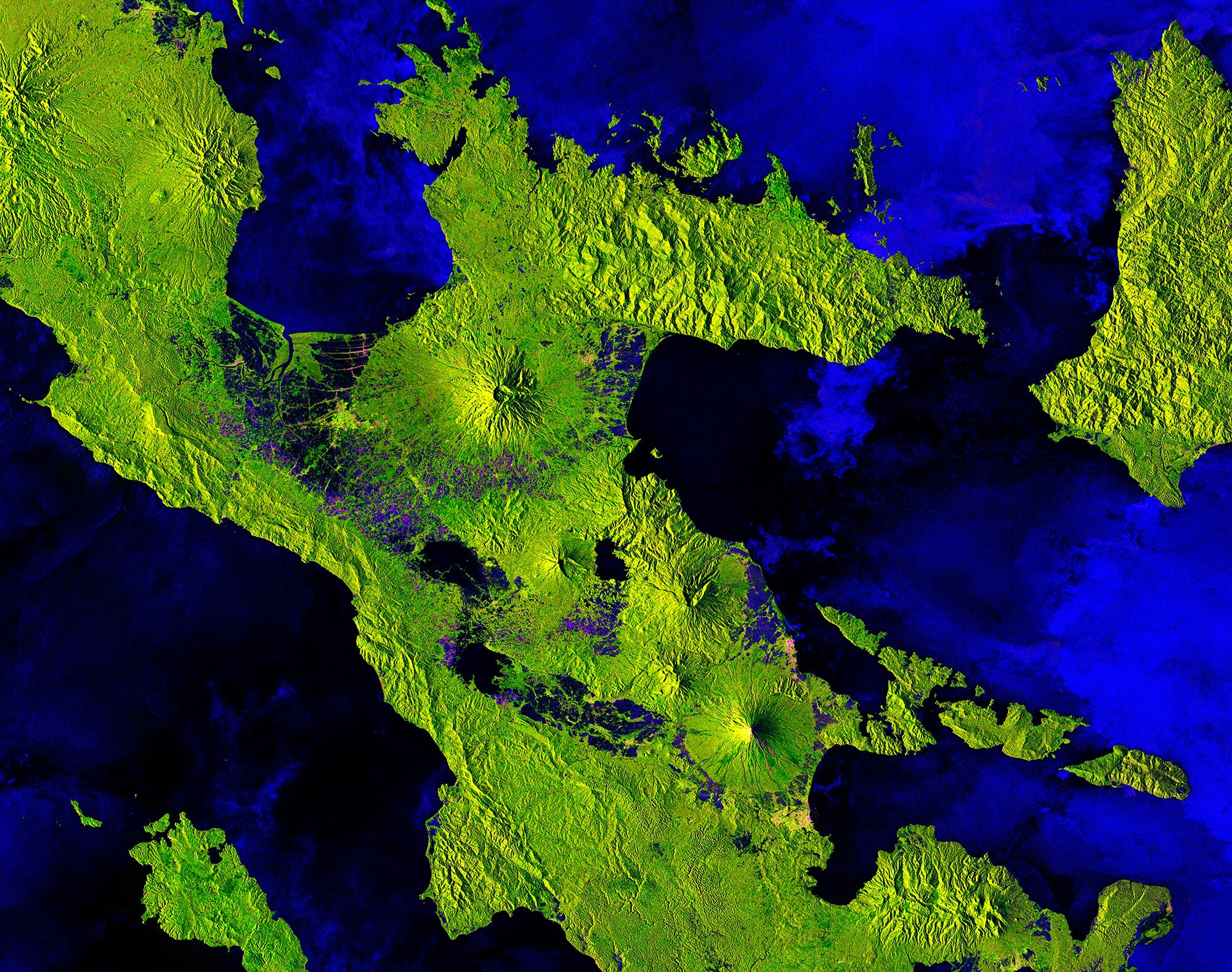
One of the satellites currently in orbit is Sentinel 1-B, a radar-imaging mission. Launched in late 2016 this spacecraft carries a 12 meter long synthetic aperture radar operating in the microwave part of the spectrum (at 5.405 GHz) and capable of scanning Earth's surface down to a scale of about 5 meters. With this data we can study sea ice, oil spills, marine winds, ocean waves and currents, land-use change, land deformation and other features, as well as respond to emergencies such as floods and earthquakes. And we can do this through cloud, rain, day or night.
By combining multiple passes of radar data the mission can detect changes and land movement on the order of millimeters. The nature of the bounced microwaves can also be calibrated to distinguish between land, water, vegetation, and even human buildings. In the images here (above and below), we're looking down on Mount Mayon on the island of Luzon in the Philippines. Bright green colors represent forest, continuous dark blue for ocean, blue patches for cultivated land, and pink for towns and even active lava (shown in closeup, lower half of the volcanic cone).
It's a remarkably textured picture of a rocky, habitable planet, caught for one brief moment during the ebb and flow of geophysics and life.
Sentinel 1-B image. Credit: Copernicus Sentinel data (2018), processed by ESA (CC BY-SA 3.0 IGO)

Close up of Mount Mayon. Credit: Copernicus Sentinel data (2018), processed by ESA (CC BY-SA 3.0 IGO)
