Spectacular Images of Mount Saint Helens's Eruption
The 1980 eruptive sequence completely changed the landscape around Mount Saint Helens. Geologists flocked there to measure and investigate, taking thousands of photos in the process. I'm gathering some of the best for your viewing pleasure
This article was published in Scientific American’s former blog network and reflects the views of the author, not necessarily those of Scientific American
I brought you some pretties, my dear volcano lovers. I've been going through the USGS ScienceBase Catalog, sorting Mount St. Helens images from the 1980 eruptive episode. I'm finding some jaw-dropping photos, many of which we'll thoroughly enjoy as our Catastrophe series continues. But I couldn't wait to share, so here's the first batch of what will be many photos that I thrust at you whilst squeeing loudly. Yes, I am that excited over the results of a volcanic eruption.
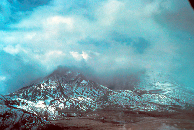
This one was taken a week after the May 18th eruption. Wow, amirite?
Oblique aerial view across Spirit Lake toward Mount St. Helens, one week after the eruption. Low cloud cover. Skamania County, Washington. May 1980. Image and caption courtesy USGS.
On supporting science journalism
If you're enjoying this article, consider supporting our award-winning journalism by subscribing. By purchasing a subscription you are helping to ensure the future of impactful stories about the discoveries and ideas shaping our world today.
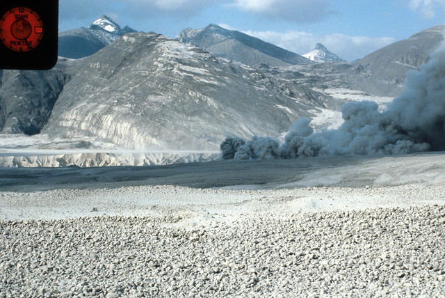
Fabulous view across the pumice plain at Mount St. Helens. This is from May 23rd, 1980.
North from pumice flow. Temperature site PT5-18-PF81, Mount St. Helens. Skamania County, Washington. May 23, 1980. Image and caption courtesy USGS.
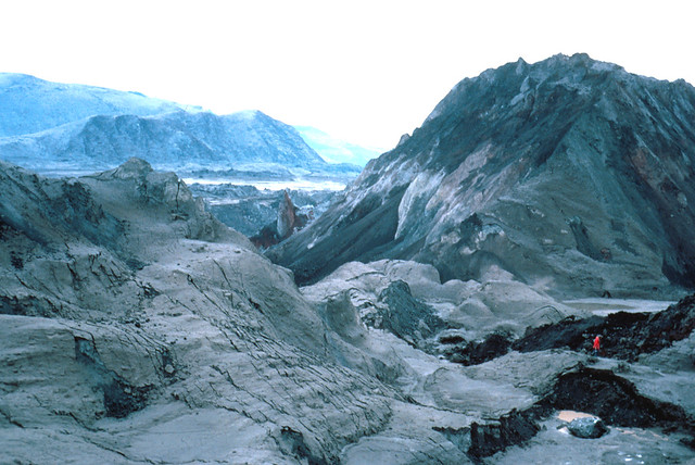
Here's an image that will give you a feel for the scale of the debris avalanche. There's a full-grown human in there somewhere.
Debris-avalanche deposit from Mount St. Helens. Don Swanson in foreground for scale. Skamania County, Washington. May 22, 1980.
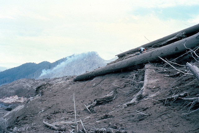
Really excellent photo here showing debris from the May 18 eruption in the foreground. Note the geologist for scale. On the hillside beyond, you can see where the lateral blast annihilated the forest. See how sharp the line is where it stopped? This is two days after the eruption: I'm not sure if the fire burning was set off by the blast or is one that started after.
Debris from Mount St. Helens in South Fork of Toutle River. Geologist in background for scale. Cowlitz County, Washington. May 20, 1980. Image and caption courtesy USGS.
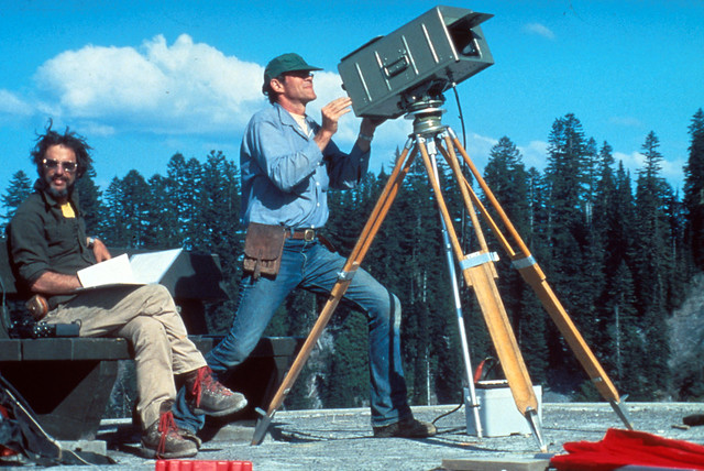
This looks like a total 80s glamour pose thing. It's actually srs scientific bizness.
U.S. Geological Survey personnel using geodimeter to measure deformation of north flank of Mount St. Helens. Skamania County, Washington. May 4, 1980. Image and caption courtesy USGS.
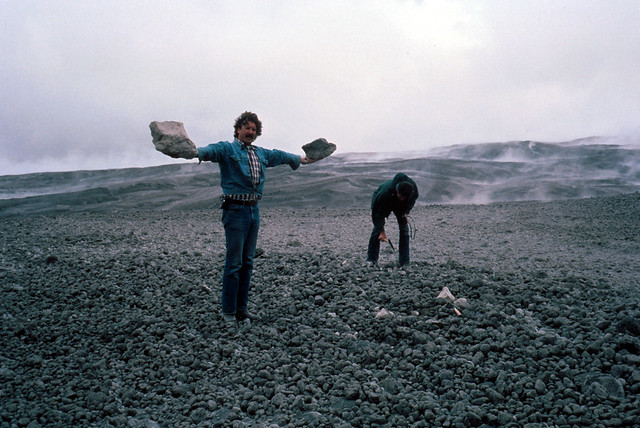
Duuuuude this is some seriously large pumice.
Pumice from Mount St. Helens. Skamania County, Washington. May 21, 1980. Image and caption courtesy USGS.
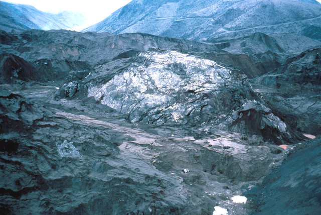
Soooo in case you ever wondered what it looks like when a volcano falls down and takes its glaciers with it, it's this:
Large block of ice in the debris-avalanche deposit from Mount St. Helens. Skamania County, Washington. May 22, 1980. Image and caption courtesy USGS.
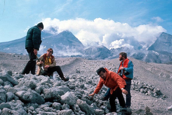
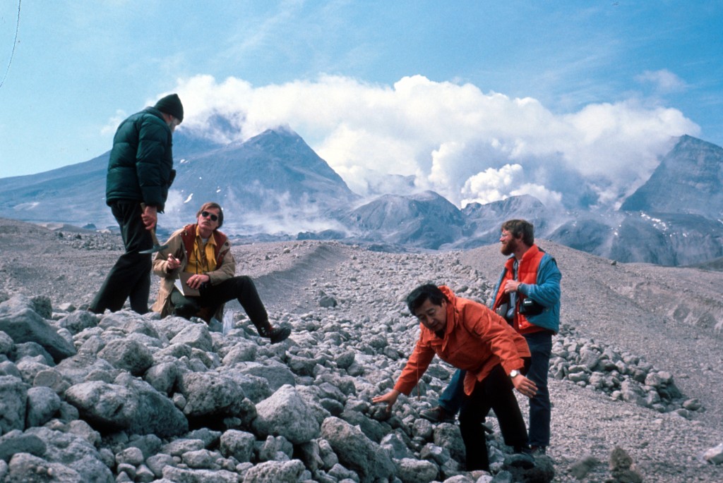
Love this photo of several geologists on a Mount St. Helens ash flow (well, the photo description says ash, but that looks rather like pumice to me). Can you imagine having a job like this?
Geologists on Mount St. Helens May 25 ash flow. Skamania County, Washington. May 30, 1980. Image and caption courtesy USGS.
I hope you've enjoyed our first edition. Stay tuned for many more! And if you can't wait, follow me on Facebook, where I've been posting them as I go along.
Subscribe to Support Independent Journalism
Great science journalism requires human expertise, time, effort and creativity. And it costs money. That’s why I and the journalists here at Scientific American hope you’ll join our community.
When you subscribe, you are supporting staff and freelance journalists who are passionate about telling science stories that are true, important and compelling. Our editors and reporters are often experts in their fields, which means they understand the nuances of big discoveries and can untangle the breakthroughs from the hype. With a subscription, you are also supporting rigorous fact-checking to ensure the words we publish are precise and accurate. And you’re supporting original illustrations, graphics and photos that bring you closer to an advanced laboratory, an ice sheet in Antarctica or a space mission in orbit. You’re helping us craft other types of high-quality journalism as well: Our newsletters are carefully written, edited and curated by staffers you have or will come to know and love. Our Science Quickly podcast is based on original reporting, collaboration with editors and scientists and exacting production.
Subscriptions keep this engine running so we can continue to deliver thoughtful, rigorous and independent science journalism to you. In an era of viral misinformation, this work is crucial. If you value what we do, I hope you’ll consider joining us as a subscriber
Thank you,
Jeanna Bryner, Editor in Chief, Scientific American