New Issue: Orbital Catastrophe Ahead? Read Now

Hurricane Melissa Images Reveal a Monster Storm for the Record Books

These images of Hurricane Melissa show the Category 5 storm in all its power

A photograph of the swirling storm clouds of Hurricane Melissa

Cooperative Institute for Research in the Atmosphere, Colorado State University/National Oceanic and Atmospheric Administration

Join Our Community of Science Lovers!

With maximum sustained winds of 185 miles per hour as it batters the Caribbean island of Jamaica on Tuesday, Hurricane Melissa is a beast of a storm. Satellite and other images starkly illustrate Melissa’s monstrosity, from its rapid intensification to the sheer power of the convection at its core. Here’s an inside look at one of the strongest storms to ever make landfall in the Atlantic since recordkeeping began.
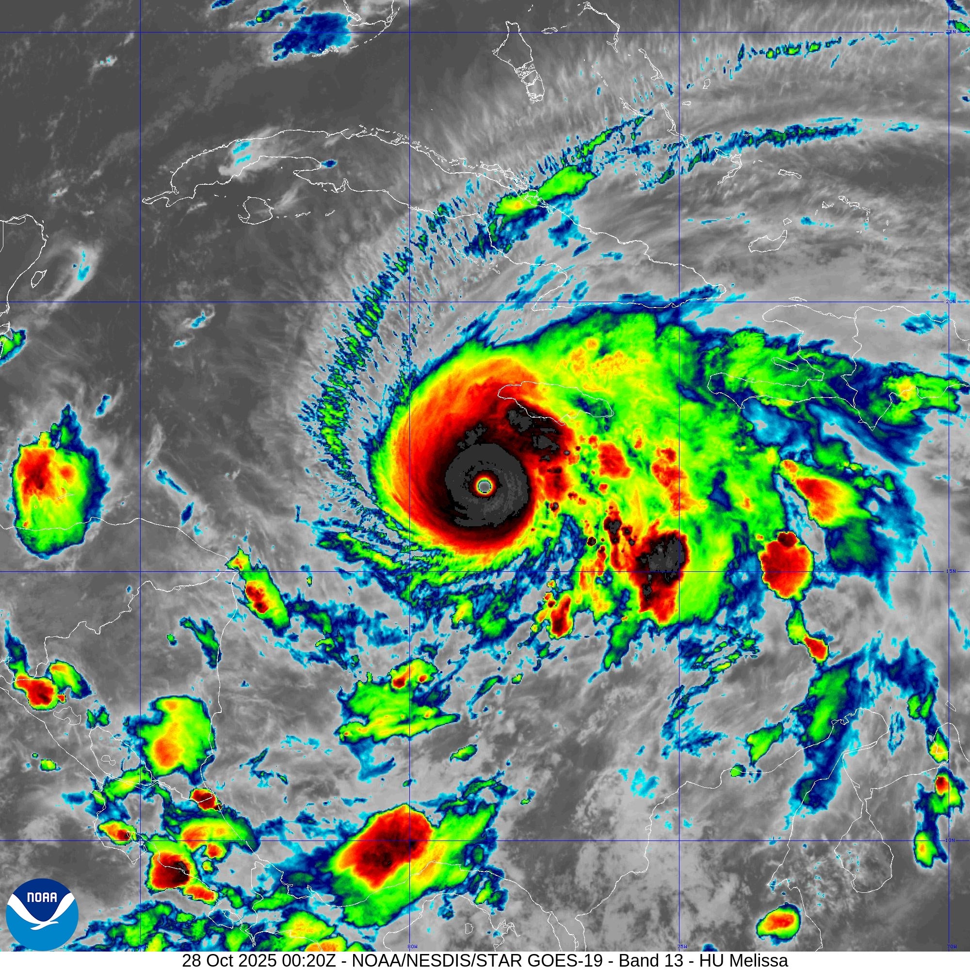
The swirl and eye of hurricane Melissa as seen by a weather satellite from above.

CIRA/NOAA

Melissa’s cold cloud tops underscore the storm’s strength. The engine at the heart of any tropical cyclone is the convection powered by the temperature difference between the warm sea surface and the cold atmosphere at the top of the storm, where air flows out.


On supporting science journalism

If you're enjoying this article, consider supporting our award-winning journalism by subscribing. By purchasing a subscription you are helping to ensure the future of impactful stories about the discoveries and ideas shaping our world today.


Image inside Hurricane Melissa as a hurricane hunting plane flies through the storm.

Lt. Col. Mark Withee, U.S. Air Force

On October 27 a crew from the Air Force’s “Hurricane Hunters,” or 53rd Weather Reconnaissance Squadron, flies through Hurricane Melissa to collect information for the National Hurricane Center.

Inside the eye wall of Hurricane Melissa - looks like a big circular cloud with a plane propeller showing.

Lt. Col. Mark Withee, U.S. Air Force

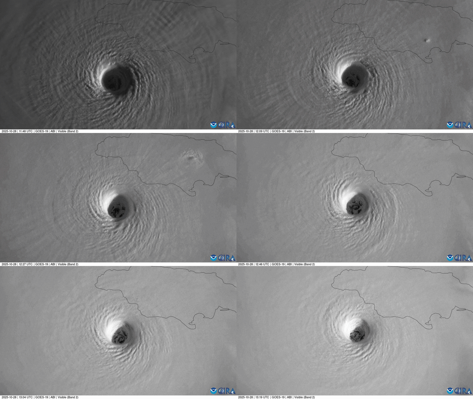
The calm, clear eye of Melissa appears with the “stadium effect” of the clouds in the eye wall—where the strongest winds are—as seen from the Hurricane Hunters aircraft.
Swirling cyclone of hurricane Melissa with blue lightning flashes

CIRA/NOAA

Another view shows Melissa’s central eye, which looks like a textbook eye for a strong hurricane.
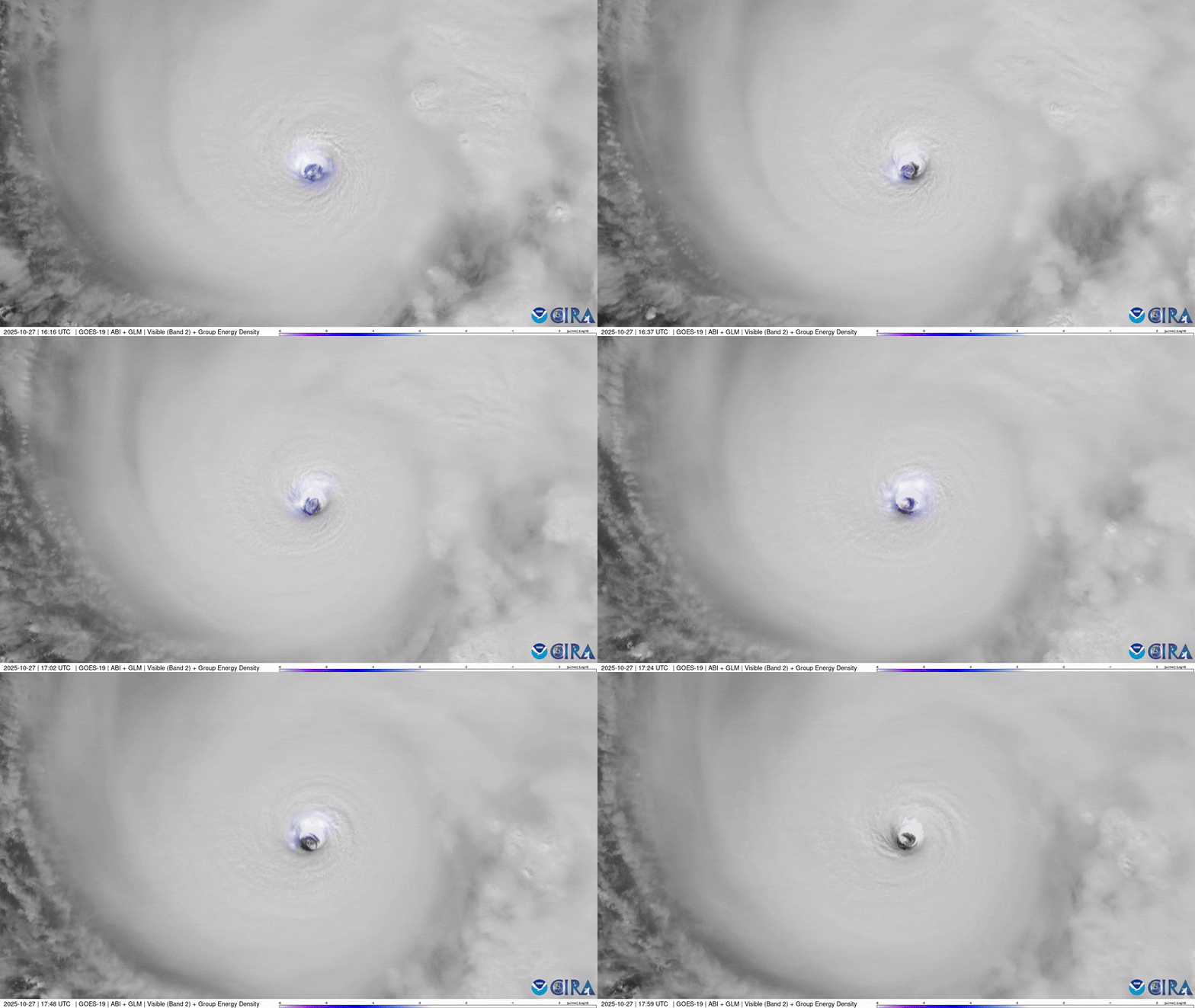
Lightning flashes within the eye of hurricane Melissa.

CIRA/NOAA

Lightning flashes in the eye wall of Category 5 Melissa are a marker of how strong the storm is. It reached a central pressure of 892 millibars, among the lowest ever recorded in the Atlantic Ocean. It is tied as the third most intense Atlantic storm with the devastating 1935 Labor Day hurricane.

satellite image of the eye of the storm inside hurricane Melissa

CIRA/NOAA

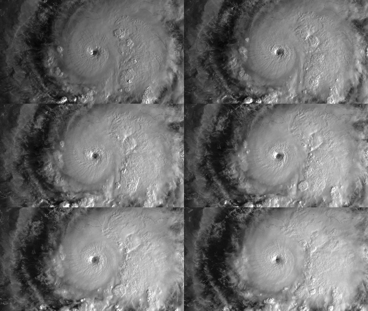
Hurricane Melissa swirls above the Caribbean Sea in fading sunlight on October 26.

Andrea Thompson is senior editor for Earth and environment at Scientific American, covering the environment, energy and Earth sciences. She has been covering these topics for nearly two decades. Prior to joining Scientific American, she was a senior writer covering climate science at Climate Central and a reporter and editor at Live Science, where she primarily covered earth science and the environment. She has moderated panels, including as part of the United Nations Sustainable Development Media Zone, and appeared in radio and television interviews on major networks. She holds a graduate degree in science, health and environmental reporting from New York University, as well as a B.S. and an M.S. in atmospheric chemistry from the Georgia Institute of Technology. Follow Thompson on Bluesky @andreatweather.bsky.social

More by Andrea Thompson

Jeanna Bryner is editor in chief of Scientific American. Previously she was editor in chief of Live Science and, prior to that, an editor at Scholastic's Science World magazine. Bryner has an English degree from Salisbury University, a master’s degree in biogeochemistry and environmental sciences from the University of Maryland and a graduate science journalism degree from New York University. She has worked as a biologist in Florida, where she monitored wetlands and did field surveys for endangered species, including the gorgeous Florida Scrub Jay. She also received an ocean sciences journalism fellowship from the Woods Hole Oceanographic Institution. She is a firm believer that science is for everyone and that just about everything can be viewed through the lens of science.

More by Jeanna Bryner

Subscribe to Support Independent Journalism

Great science journalism requires human expertise, time, effort and creativity. And it costs money. That’s why I and the journalists here at Scientific American hope you’ll join our community.

When you subscribe, you are supporting staff and freelance journalists who are passionate about telling science stories that are true, important and compelling. Our editors and reporters are often experts in their fields, which means they understand the nuances of big discoveries and can untangle the breakthroughs from the hype. With a subscription, you are also supporting rigorous fact-checking to ensure the words we publish are precise and accurate. And you’re supporting original illustrations, graphics and photos that bring you closer to an advanced laboratory, an ice sheet in Antarctica or a space mission in orbit. You’re helping us craft other types of high-quality journalism as well: Our newsletters are carefully written, edited and curated by staffers you have or will come to know and love. Our Science Quickly podcast is based on original reporting, collaboration with editors and scientists and exacting production.

Subscriptions keep this engine running so we can continue to deliver thoughtful, rigorous and independent science journalism to you. In an era of viral misinformation, this work is crucial. If you value what we do, I hope you’ll consider joining us as a subscriber

Thank you,

Jeanna Bryner, Editor in Chief, Scientific American

Subscribe