
Editor’s Note (4/8/21): On March 31, 2021, Russia submitted documents to an international commission claiming that far more of the vast Arctic Ocean seafloor belongs to that country. In recent years the five nations bordering the ocean—Russia, the U.S., Canada, Norway and Denmark (via its territory of Greenland)—have submitted claims that certain large portions of the Arctic seafloor are natural extensions of their continental shelf, giving them rights over those regions. But Russia’s new claim would take an additional 200,000 square kilometers from Denmark and even more from Canada. The original claims, and the science behind them, are detailed in our 2019 article below. More on the new Russian submission can be found in Arctic Today.
On August 2, 2007, three Russian explorers crammed inside a submersible underneath thick sea ice at the North Pole descended 4,300 meters to the dark seafloor below. They extended a robot arm from the pod and planted a titanium national flag in the sediment there. After surfacing to the supporting nuclear-powered icebreaker, expedition leader and parliament member Artur Chilingarov told an onboard reporter for the Russian news agency Itar-Tass, “If 100 or 1,000 years from now someone goes down to where we were, they will see the Russian flag.” President Vladimir Putin phoned the ship, expressing his congratulations.
Canadian geophysicist David Mosher wasn't impressed when he heard the news at his Bedford Institute of Oceanography office in Nova Scotia. He glanced at a small cylinder of dried, dense mud about the size of a bratwurst lying on a plastic tray on his bookshelf. It was a short piece of a 13-meter-long sediment core extracted from the same North Pole seabed—in 1991, when Mosher was a Ph.D. student at Dalhousie University in Halifax. He had ventured there with 40 international scientists on two research icebreakers from Germany and Sweden. The scientists sent a piston corer to the seafloor, drilled down and extracted the sample from the heavy sediment.
On supporting science journalism
If you're enjoying this article, consider supporting our award-winning journalism by subscribing. By purchasing a subscription you are helping to ensure the future of impactful stories about the discoveries and ideas shaping our world today.
“We didn't plant a flag,” Mosher quips. “We made the hole for the Russians to plant one.”
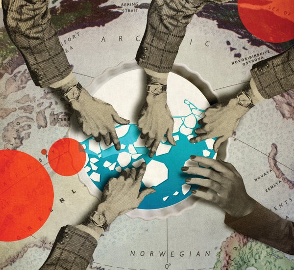
Setting the flag was a political stunt done mostly to boost the morale of Russians, who were suffering through a deep recession. But the bald declaration for the North Pole made clear to the other four Arctic coastal states that the time had come to formally claim any portion of the Arctic Ocean seabed they felt they had rights to.
One of those countries was on top of it; a year earlier Norway had submitted geologic data and maps outlining three patches of seabed to the international Commission on the Limits of the Continental Shelf (CLCS), which reviews such claims and determines whether science has been applied properly. The Kingdom of Denmark, which includes Greenland, took several more years to amass a huge amount of data and submitted a pile of files in 2014, asserting it had rights to a large section of the Arctic Ocean seafloor covering 900,000 square kilometers. Russia handed in its paperwork in 2015, charting 1.3 million square kilometers—twice the size of Texas—which overlapped more than half of Denmark's outline.
This May a Canadian team led by Mosher, who is now a geophysics professor at the University of New Hampshire, submitted 2,100 pages of text, coordinates and measurements from multibeam sonars, gravitometers and core samples to the CLCS, stating that 1.1 million square kilometers of the seabed are part of Canada. The expanse greatly overlaps the Russian and Danish claims. The U.S., the fifth state with an Arctic coastline (along Alaska), will not present its pitch until at least 2022, but its plot is expected to overlie Canada's.
For most of modern history, countries viewed the Arctic Ocean as a largely useless slab of ice. But then it started to melt, exposing opportunities. A 2008 study by the U.S. Geological Survey concluded that thick sediment in the Arctic could hold 30 percent of the world's yet to be discovered natural gas and 13 percent of its oil. Valuable iron and rare earth minerals could be waiting, too. Retreating sea ice meant shipping lanes could be opened and exploited. Seeing a bountiful future, each of the five countries became eager to secure as much territory as possible. “You never know what will happen,” says Flemming Getreuer Christiansen, deputy director of the Geological Survey of Denmark and Greenland.
The CLCS could take years to work through the submissions. It moves slowly, in part because it has more than 80 cases for seafloor worldwide, from Nicaragua to Ghana to Vietnam. It is not expected to finish evaluating Denmark's or Russia's tender for several years. The Canadian review will conclude years after that. The commission does not adjudicate overlapping claims either, so once all the reviews are done countries will have to start diplomatic proceedings, putting their CLCS determinations on the table and negotiating boundary lines, another step that could take a long time.
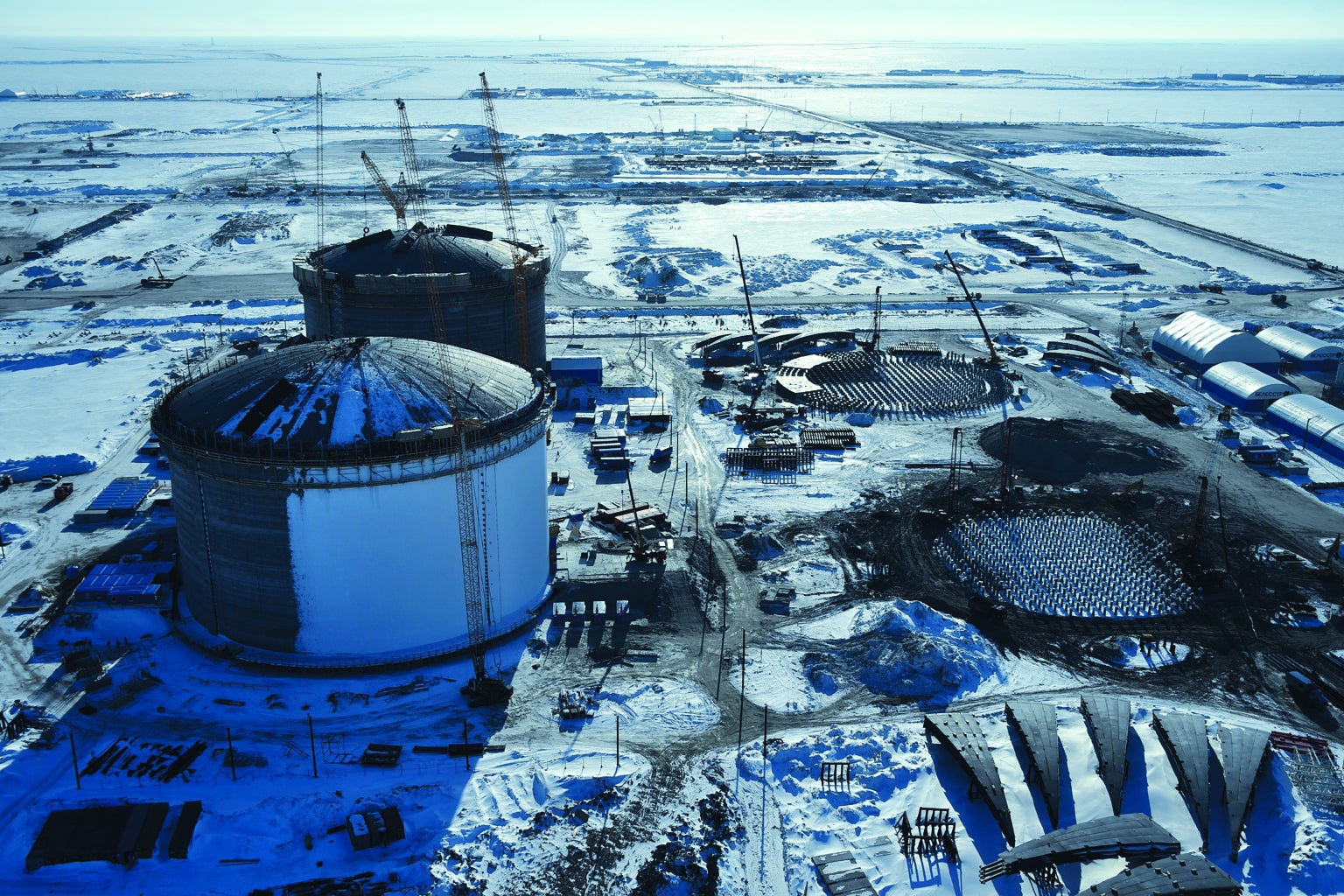
Storage tanks to hold liquefied natural gas are built at the Yamal LNG complex, funded in part by China and France, at the expanding Sabetta port on Russia's Arctic coast. Nations bordering the Arctic Ocean are increasingly eager to explore for gas and oil under the seafloor, and nations farther away are eyeing potentially lucrative investment opportunities. Credit: Kirill Kudryavtsev Getty Images
The mapping and submission process has been civil, even cooperative, firmly grounded in geology. But the glacial pace of the process is problematic. While the scientists methodically work through the various countries' claims, Putin is expanding military bases across Russia's long Arctic shoreline. His speeches and actions have made it clear that he thinks his nation should direct the polar region. Meanwhile NATO countries are reinforcing northern militaries, wary that Russia could take over seabed the way it annexed Crimea in 2014. China is sending ships up north to signal that it, too, wants a role.
The U.S. has historically paid little attention to the region, but now it is throwing its weight around. In May, Secretary of State Mike Pompeo arrived at an Arctic Council meeting in Finland and declared that Russia was acting aggressively and China had to be watched closely. For the first time in 23 years, the meeting ended without the participants signing a declaration of cooperation. All the posturing could make boundary negotiations contentious, with opposing sides disregarding the science instead of compromising over it. Even worse, headstrong leaders might simply run out of patience with the CLCS's review and take what they think is theirs.
Lomonosov is mine
For centuries nation-states saw the oceans as wild. In the 1600s they began to assert rights over the first three miles (4.8 kilometers) of seawater, based on the longest distance of a cannon shot. That practice held until the 20th century, when countries started to unilaterally claim rights out to various distances, threatening the long-standing concept of freedom of the high seas. To settle matters, in 1982 more than 160 countries agreed to the United Nations Convention on the Law of the Sea (UNCLOS). It established that a nation bordering any of the earth's oceans has an exclusive economic zone, or EEZ, reaching from its shoreline 200 nautical miles (370.4 kilometers) out to sea. It has all rights to resources in and under the water. Areas beyond that line are international waters—free to all, belonging to none.
The convention left a door open. Article 76 says a state can establish sovereign rights to exploit seabed beyond 200 nautical miles if it can present detailed geologic evidence proving that its continental shelf—the gently sloping seafloor that stretches from shore far out into the ocean before dropping into the deep sea—extends beyond the 200-nautical-mile line. Here a nation would have exclusive rights to resources on and under the seabed but not in the water column above it (fishing and navigation would remain open). Arctic countries did not focus much on the provision, until sea ice began to retreat.
Article 76 presents rules a state must follow to delineate the outer edge of a proposed extended continental shelf. It describes two formulas to draw the lines as far out as geologic evidence allows. It then describes two formulas that limit those lines, so a country cannot claim a crazy proportion of any ocean.
Both the formulas for drawing lines are based on a contour called the foot of slope. Imagine standing on the shore looking out at sea. The seafloor gradually deepens over many kilometers, then drops down a slope to a much deeper bottom under the distant, central ocean. Along the base of the slope, scientists must determine the foot of slope—the place of maximum change in gradient—around their coastlines and islands.* Generating the evidence for the foot of slope “is where all the science is,” Mosher says.
Each of the Arctic Five countries, as they are known, lies along the circular rim of the pie-shaped Arctic Ocean. As they project their shelves from the perimeter toward the center, the pieces are bound to overlap: continental shelves end where plate tectonics has ended them.
Following the formulas can lead to modest overlaps, but another Article 76 provision creates a larger problem. It says a country can claim a wide band of seabed along an underwater ridge that extends from the country's continental shelf, however far the ridge goes—but it does not define what a ridge is. The language “is totally ambiguous,” says Larry Mayer, director of the Center for Coastal and Ocean Mapping at the University of New Hampshire. Mayer is seen as the leading U.S. authority on Arctic seafloor and, as it happens, spent a decade as a professor at Dalhousie, where he was Mosher's Ph.D. adviser.
The ambiguity allows geologists, as well as the lawyers in their country's state department, to interpret ridge data differently. The single feature causing the greatest overlap among Denmark, Russia and Canada is the Lomonosov Ridge. It extends 1,800 kilometers from Russia's New Siberian Islands to Canada's Ellesmere Island—right next to Greenland—dividing the Arctic Ocean in half. Some of its peaks rise 3,500 meters from the deep seafloor. The ridge is a gigantic relic from millions of years ago, when the neighboring North American and Eurasian continents began pivoting away from each other, twisting and deforming the expanding Arctic Ocean floor. The ridge's common heritage means Denmark, Russia and Canada can say it naturally extends from their continental shelves, and they can outline turf along it to call their own. The most notable spot that falls within those outlines? The North Pole.
The scientists say they are just outlining where the geology takes them. But their submission teams can also apply the science to serve certain national strategies. Russia could have outlined extended continental shelf along the Lomonosov Ridge across the center of the Arctic Ocean, all the way to Canada's 200-nautical-mile EEZ, but in its submission to the CLCS it stopped just after the North Pole. It has not stated why. When I contacted two of its team experts, Eugene Petrov and Yuri Firsov, they declined to be interviewed, with Firsov e-mailing that the issues are “rather complicated.” Rick Saltus, a senior research scientist at the University of Colorado Boulder, who has long been involved in the U.S. work, says Russia may not have had enough data near the Canadian end of the ridge; generating the details the CLCS looks for is expensive.
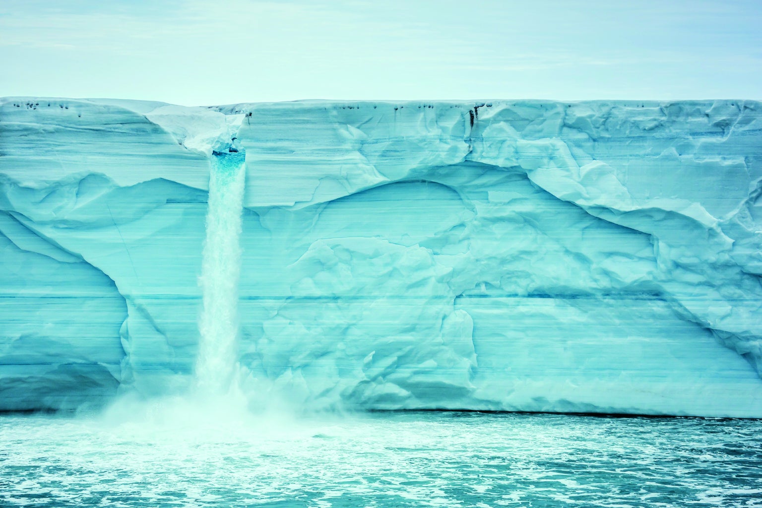
Melting ice caps in regions such as Svalbard (shown) and Greenland are exposing shorelines that can be developed, while receding sea ice exposes seafloor and shipping lanes that can be exploited throughout more of the year. Credit: Michael Nolan Getty Images
Alternatively, he says, Russia may have stopped where it did as a matter of strategy. Why complicate future boundary negotiations with Denmark and Canada? The long section of the Lomonosov Ridge that Russia did include might be more than enough to exploit.
Canada has taken a similar approach, outlining the Lomonosov Ridge from its shores outward, stopping just beyond the North Pole and overlapping Russia's outline in that region. Denmark, however, claims the ridge from Greenland across the entire ocean right up to Russia's EEZ. “We are not considering whether any other states would have claims to the same area,” says Denmark's lead scientist Finn Mørk, a geophysicist at the Geological Survey of Denmark and Greenland. It is up to negotiators, he says, to work out the overlaps—and who, in the end, can wave a flag from the North Pole.
Politics or science?
Given the vagueness of Article 76, the three declarations for the Lomonosov Ridge might all be legitimate, scientifically. But ultimately which nation secures rights to which territory is not up to the scientists: it is up to diplomats or, potentially, militaries. And rising geopolitical tension could overtake the orderly, science-based process.
First of all, the U.S. submission to the CLCS will add to the overlaps, complicating negotiations. The extent of overlap will not be revealed until the documents are handed in, which will be 2022 at the earliest, according to Evan Bloom, director for ocean and polar affairs at the U.S. Department of State and chair of the U.S. Extended Continental Shelf Project's executive committee. Mayer says the U.S. has all the data it needs. “It's just a huge process to do the analysis,” he explains.
The U.S. may be in the weakest negotiating position, however, because it has never signed the UNCLOS, unlike the rest of the Arctic Five. Plenty of U.S. officials and several presidents have recommended signing it, but a handful of treaty-wary senators have stopped the convention from ever being ratified. That may now hurt the country's own cause. “I wish the U.S. knew how much it puts itself at a disadvantage by not being a party to the convention,” says Galo Carrera, a marine researcher at Dalhousie, an honorary consul of Mexico to Canada, and a former CLCS chair.
As a result, the U.S. has no need to submit a claim to the CLCS or abide by its review. But Bloom says the U.S. will do both. It has spent $89 million to obtain thorough data. It wants the rest of the world to see that it is following the same criteria as everyone else. That gives the country “very strong standing” in future negotiations, Bloom says. And there really is no other way to make a claim. The federal government could publish a document declaring “this area of seabed is ours,” but the world would not recognize it. In a boundary negotiation, Saltus says, a country “would want the CLCS determination in its pocket.” In effect, the U.S. recognizes the UNCLOS as customary international law—the legal practice the world follows.
U.S. rhetoric is also making the Arctic more politically complicated. In June the U.S. Department of Defense released its latest Arctic Strategy, which says that although there has been a great deal of cooperation among Arctic nations, it now anticipates an “era of strategic competition” and “a potential avenue for ... aggression.”
Russia's actions could be interpreted as such. Ever since the country stormed into Ukraine, “the relationship has been strained between NATO and Russia,” says Rob Huebert, a political science professor at the University of Calgary and a former associate director of what is now the Center for Military, Security and Strategic Studies there. The Arctic coast offers Russia a critical strategic position for military power, notably nuclear war deterrence, because it is home to important nuclear submarine bases. “You can't separate the politics of the Arctic from the greater geopolitics” of the world, Huebert says, maintaining that Putin “sees the expansion of NATO as a core threat, and he will not allow that to happen.” He says Russian jets now buzz Sweden and Finland because those countries are considering joining NATO. In March, Sweden hosted an enormous military exercise in its northernmost region with thousands of NATO troops. Because of Russia's Arctic buildup, U.S. Army General Curtis Scaparrotti told a Senate panel that same month that the U.S. military has to do more up north as well.
Russia may have another reason, beyond military strategy or oil and gas, for controlling big swaths of the Arctic seas. “It is about nationalism,” says Andrew Holland, chief operating officer at the nonpartisan American Security Project. “‘We are the Russians. We are the Arctic power, and we should have rights to all of this.’”
Other geopolitical experts say the potential for Arctic confrontation is overplayed. Heather Exner-Pirot, a research fellow at the Center for Interuniversity Research on the International Relations of Canada and Quebec and an editor of the annual online Arctic Yearbook, which analyzes the state of Arctic politics, disagrees with Huebert, her former Ph.D. adviser. “People think there is competition in the Arctic,” she says. “But what it is, really, is an oligopoly of five states that have a monopoly on the Arctic Ocean. They are thrilled with this.”
The Arctic Five countries codified this situation in 2008, when they signed the Ilulissat Declaration, an agreement that says each nation will work together to safeguard marine traffic, prevent oil spills and peacefully resolve differences. It also says the countries will block any larger international attempt to govern the Arctic, as well as any other nation that might show up and try to drill for oil or gas without permission. No other countries, and no Arctic indigenous peoples, were involved.
If squabbling among members of the Arctic Five does not jeopardize orderly resolution of seafloor claims, two other wild cards could. China's economic ambitions are one of them. In 2013 President Xi Jinping unveiled the country's Belt and Road Initiative, intended to create an economic network among numerous nations by building extensive infrastructure in them all. China now heads projects in more than 60 countries worth hundreds of billions of dollars. Some world leaders worry that China's real plan is to command an enormous alliance across all of Asia. Part of the initiative is known as the Polar Silk Road, intended to develop Chinese shipping routes across the Arctic and business deals with countries along those corridors. In 2017 Xi held individual summits with the heads of Arctic nations. Not to be outdone, Putin, who has his own Eurasian vision, met one on one with leaders of Finland, Sweden, Norway and Iceland during the fifth International Arctic Forum, held in April in St. Petersburg.
The second wild card is Greenland, which has been a territory of Denmark since 1953. Although Denmark granted Greenland self-rule in 2009, the territory's 2018 political elections were a referendum supporting full independence. What has prevented secession is that the nearly 60,000 residents, who sparsely populate the largest island in the world, depend heavily on Denmark for subsidies and defense. But as ice and snow recede, China is investing in mining there. Other nations, including the U.S., are investing as well. Greenlanders are thinking they could stand on their own. Denmark has already given Greenland the seabed rights to resources within the EEZ around the island.
An independent Greenland could join NATO; the U.S. has a large air force base there. Or it could partner with China, or even Russia, to develop the thawing countryside. If Greenland becomes an independent state, Denmark could hand over the extended continental shelf claims mapped from the island's long coast. In that case, shelf negotiations might have to be recast with Greenland as the government in control—more potential delay.
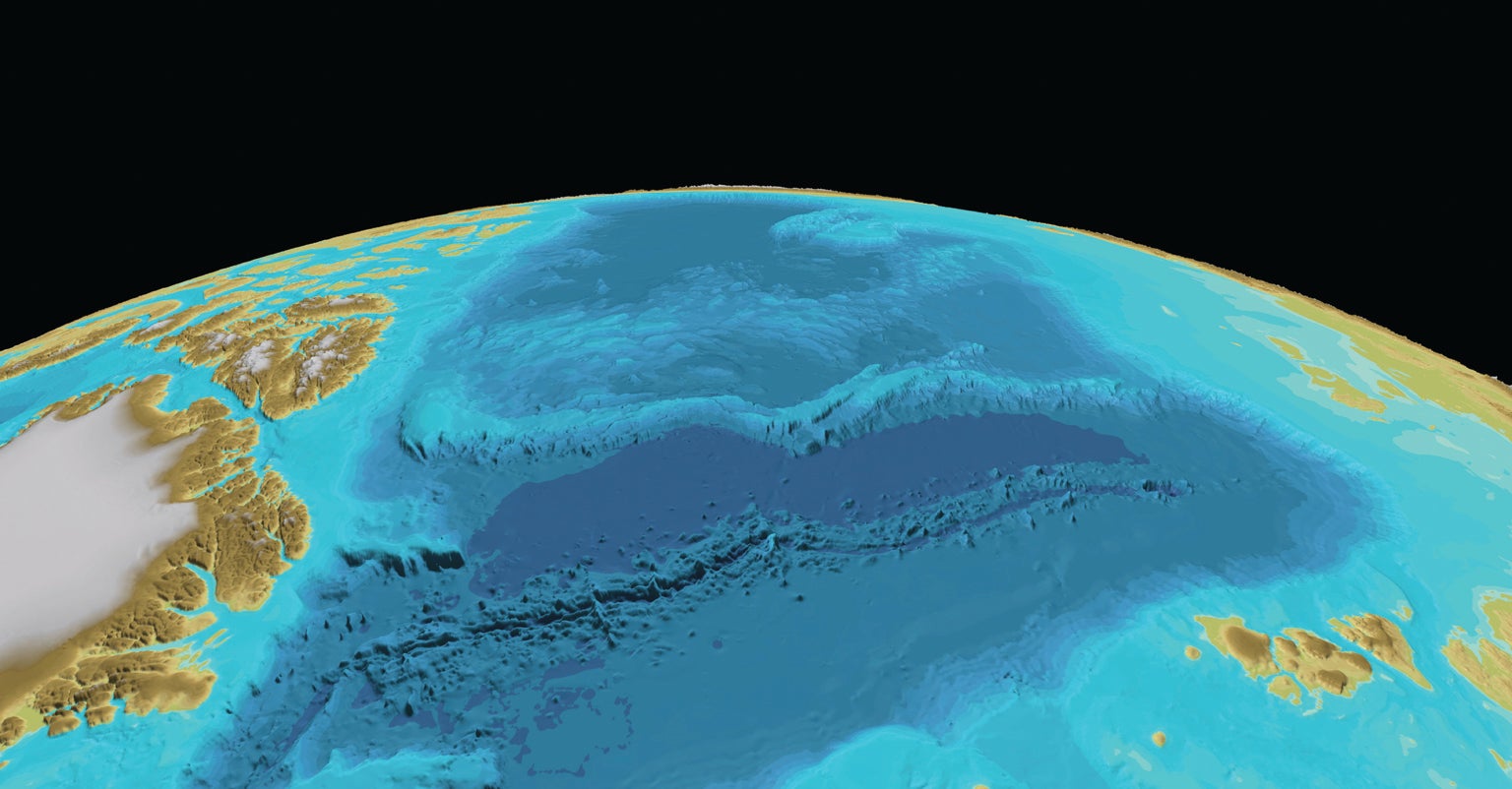
Lomonosov Ridge (white band in center) extends across the Arctic Ocean seafloor from Canada and Greenland (part of Denmark) (left) to Russia (right). All three states say they have rights to exploit it because it is part of their underwater continent. Credit: Martin Jakobsson Science Source
End game
Although lead scientists from the Arctic Five did not want to say much on the record about future boundary negotiations involving overlaps, some of them seem uneasy with the pace of the CLCS process. Nine of them—including Mosher from Canada, Mayer and Saltus from the U.S., Mørk from Denmark, and Petrov and Firsov from Russia—are working to set a common base of slope for the entire Arctic Ocean, and they are drafting a paper for a peer-reviewed journal. That would make a statement that the countries have calculated their foot of slope within the base of slope—the basis for the formulas—in the same way. Seeing such an agreement, perhaps the CLCS would speed up its reviews.
If the CLCS signs off on the Arctic Five submissions as is, only a small bit of the Arctic Ocean seabed may be left unclaimed. This space, known simply as the Area, might amount to two modest parcels far out at sea, Saltus says. The rest of the world may not be happy with that outcome. Sometimes the Arctic nations think the Arctic Ocean is their backyard, Carrera explains, but many other countries, as well as indigenous peoples, see it as a global commons. They believe they have a right to explore it for resources and to conduct research there.
Some of them think the world should formally establish the Arctic Ocean as a commons. They cite the Antarctic Treaty System as a model. In force since 1961, it sets aside all the land and ice shelves as a scientific preserve and bans military activity. It also protects more than 20 million square kilometers of the Southern Ocean around the continent. But no one lives in the Antarctic. There are no coastal states. It is more remote and more frozen. There is little insight about resources, and it offers no strategic advantage. As the Arctic warms, the once solitary home of indigenous peoples who lived off its wildness instead of trying to master it will be diced up and developed like the rest of the world to its south. Whether science or politics drives that development, it is underway.
*Editor’s Note (7/23/19): This sentence was edited after posting. It originally defined the foot of slope as the place of maximum steepness.
