

A newly created high-resolution map of the roads that threaded across the Roman Empire charts the ancient network from Great Britain to North Africa and has added more than 60,000 miles of roads that were never recorded before. “For the first time, we have a good, Empire-wide overview of almost the complete Roman road network with main and secondary roads,” says archaeologist Adam Pažout of the Autonomous University of Barcelona, a co-lead author of a new study describing the research that was published on Thursday in Scientific Data.
The new map—an online database dubbed Itiner-e—was compiled from several sources, including earlier databases, satellite photographs and archaeological reports. It reveals the true extent of the crucial road network as it was in the year C.E. 150—a time of prosperity in the Roman Empire—including highways between settlements, military roads for Roman soldiers and local routes that were overlooked in earlier research. The map will help scientists better understand issues such as mobility, trade and the spread of diseases, the study’s authors say.
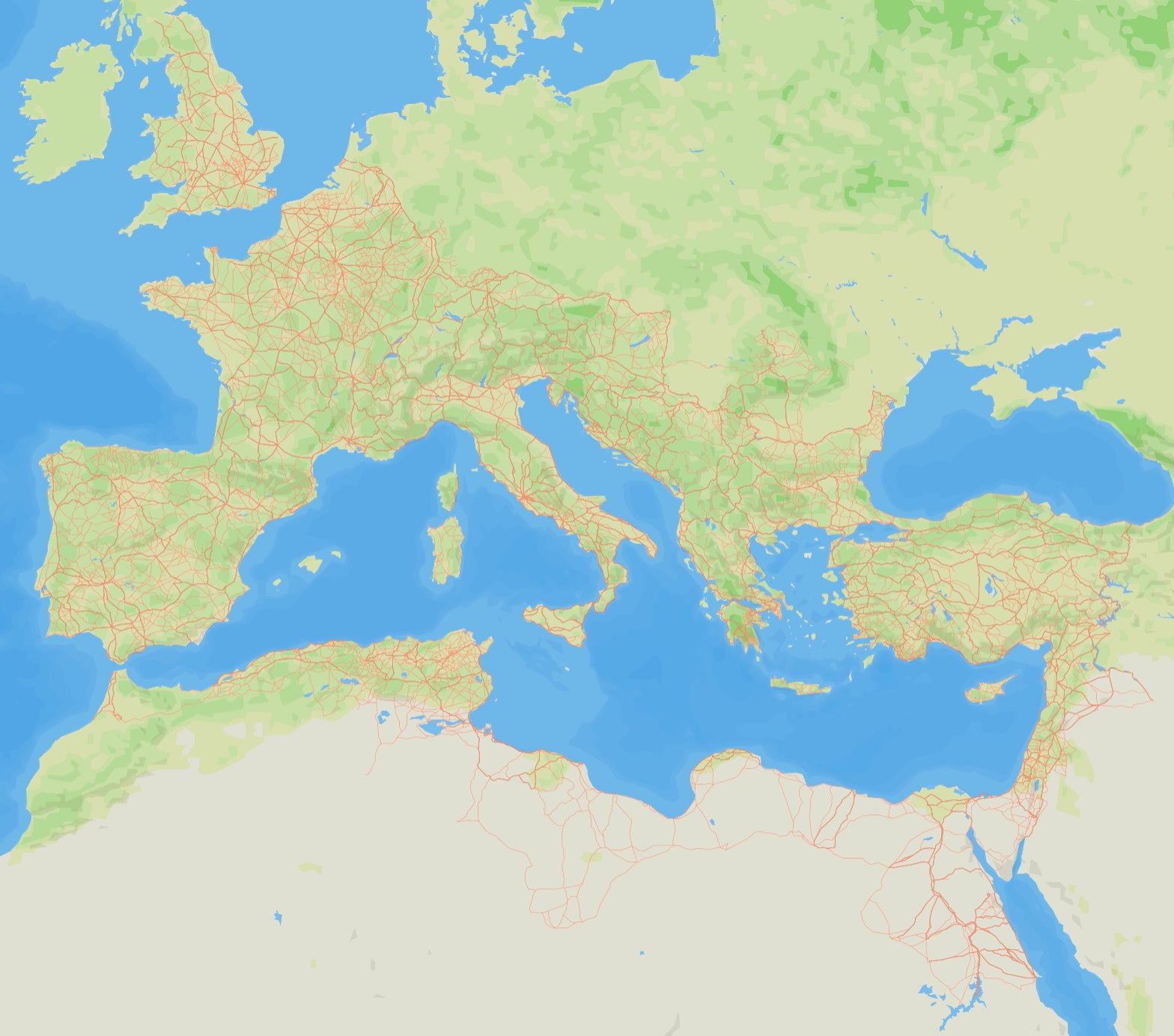
The map of the Ancient Roman road network created by Itiner-e.
Itiner-e
On supporting science journalism
If you're enjoying this article, consider supporting our award-winning journalism by subscribing. By purchasing a subscription you are helping to ensure the future of impactful stories about the discoveries and ideas shaping our world today.
Many Roman roads are now modern roads between cities, such as the section of the U.K.’s A5 highway between London and Wroxeter, England, near the Welsh border, which was built along the route of a major Roman road that was later called Watling Street. But others were only local. “The roads are anywhere that the Romans walked,” says archaeologist and co-lead author Tom Brughmans of Aarhus University in Denmark. “There were villas and towns and farms all over the Roman Empire, and every one of them was reachable by a road.”
The greatest Roman roads, such as the Appian Way, which led south from Rome, were built well with layers of sand, gravel and stone. First Italy and then Rome’s more distant territories were transformed by a web of roads that connected settlements and let Roman armies move where they were needed, says historian Ray Laurence of Macquarie University in Australia, who was not involved in the study. “Fundamentally, the road system underwrote the development of a Roman empire,” he says.
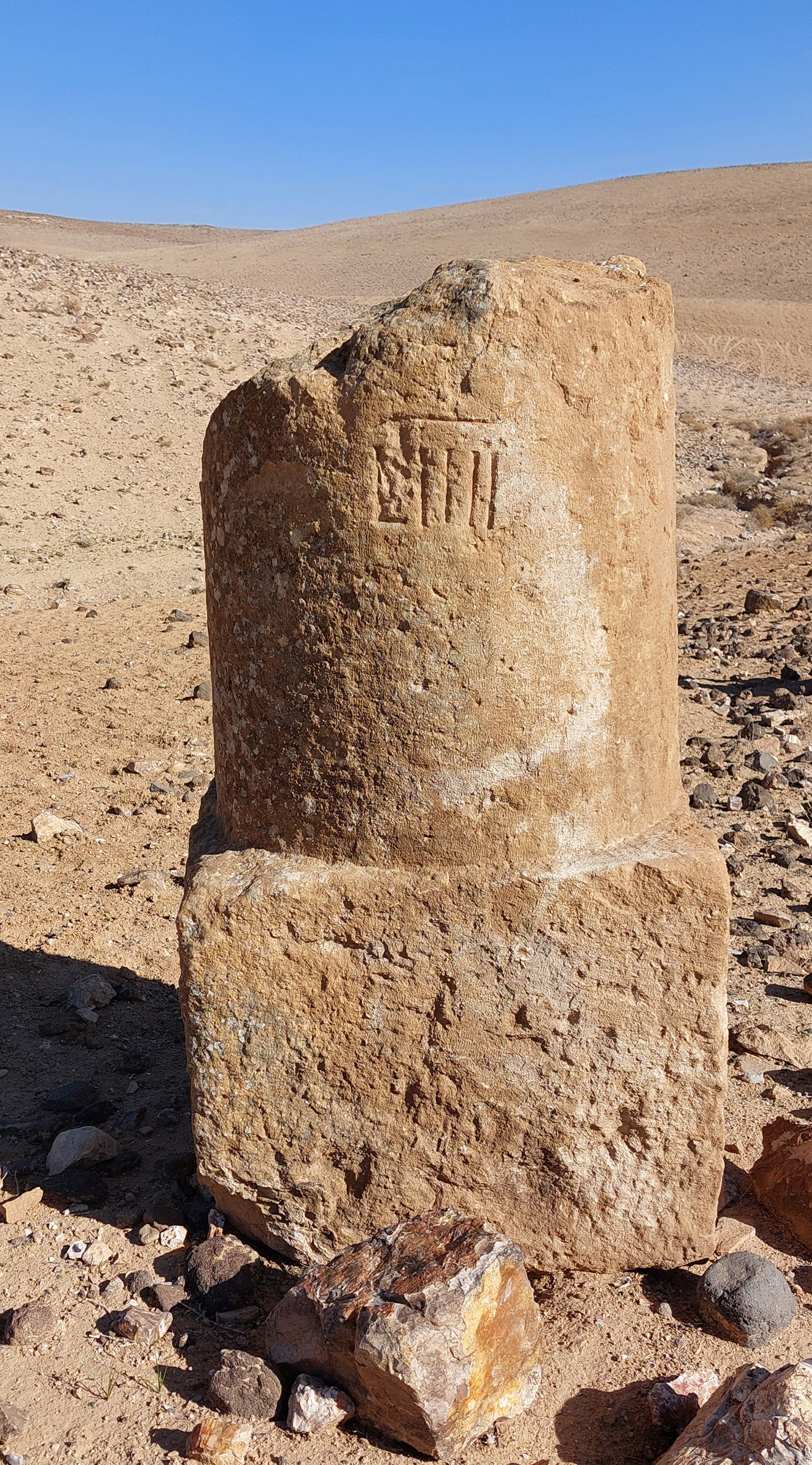
The fragment of an Ancient Roman milestone erected along the road Via Nova in modern-day Jordan.
Adam Pažout, Itiner-e
The Itiner-e dataset details more than 185,000 miles of Roman roads—nearly double the length reported by earlier studies. But Brughmans cautions that only a few percent of this length is known with certainty, whereas almost 90 percent is “conjectured” based on good evidence. For example, in what is today Israel, a road that ran between the coast and a military camp appeared in Roman records. And about 7 percent of the more than 185,000 miles of roads is “hypothetical”—that is, it represents where roads are expected to have existed but where there isn’t good evidence of their exact locations. “Thanks to our work, we know that localizing Roman roads precisely requires more research attention,” Brughmans says. “It’s a ‘call to action’ that gives us a precise confidence map of what we don’t know and where to look next.”