
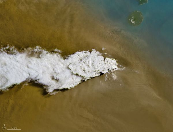
In the sea between the Indonesian islands of Java and Sumatra lies Anak Krakatau.
This volcanic island emerged from the remnants of the infamous 1883 eruption of Krakatoa, which lasted for more than five months and is considered one of the most destructive eruptions in history. Anak Krakatau rose out of Krakatoa’s caldera, which was submerged beneath the waves, and formed a small island by 1930.
Since then it has had regular volcanic activity. But last week the volcano put on such a show that even satellites caught a glimpse. For more than 24 hours on September 5 and 6, it erupted, shooting gas and ash high into the sky.
On supporting science journalism
If you're enjoying this article, consider supporting our award-winning journalism by subscribing. By purchasing a subscription you are helping to ensure the future of impactful stories about the discoveries and ideas shaping our world today.
Images from the NASA–U.S. Geological Survey Landsat 8 satellite captured the ash billowing across the Indian Ocean. The eruption disrupted thousands of flights and temporarily shut down eight airports across the two islands. According to Indonesia’s meteorological agency, the ash rose to 20,000 feet in an area east of the volcano and to 50,000 feet in a region to its west.

A previous strong eruption of Anak Krakatau caused a catastrophic landslide and tsunami in 2018. For now, officials have resumed flights on the two islands, but the volcano remains at Indonesia’s second-highest alert level even as it has returned to its more mild, sporadic eruptions.
Anak Krakatau is in the Pacific Ring of Fire, a 25,000-mile-long tectonic hotspot that almost encircles the Pacific Ocean. It contains about two thirds of the world’s active volcanoes.