
An oil tanker seized by U.S. forces off the coast of Venezuela this week has shone a light on a technique that experts say so-called dark-fleet ships frequently use to disguise their location. Known as “spoofing,” the method involves manipulating a ship’s automatic identification system (AIS), a radio tracker that broadcasts its position and identifiers to other vessels and ports. Instead of broadcasting its real-time coordinates, a spoofing ship sends out a fake location.
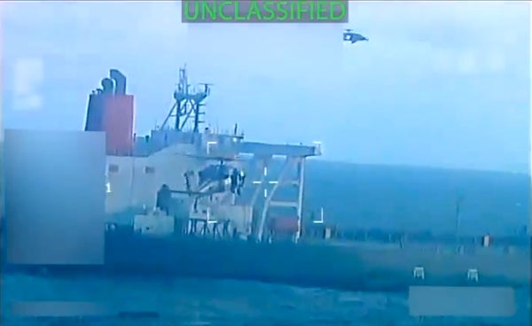
The tanker, which was previously sanctioned for alleged smuggling in 2022, is a large crude carrier with capacity for at least 1.1 million barrels of oil. When it was seized, it was reportedly sailing under the flag of Guyana, although the Guyanese government has said it was not authorized to do so. U.S. officials have not disclosed how they found the tanker. But according to Windward—a large maritime data company—it is allgedly thought to have been part of “dark fleet” network of tankers that secretly move sanctioned oil around the world using deceptive tactics such as fake flags or AIS manipulation.
AIS is mandated by international law for large ships above a certain tonnage. But dark-fleet oil tankers have long manipulated it in order to skirt scrutiny, says Matt Smith, lead oil analyst for the Americas at Kpler, a global trade analysis firm.
On supporting science journalism
If you're enjoying this article, consider supporting our award-winning journalism by subscribing. By purchasing a subscription you are helping to ensure the future of impactful stories about the discoveries and ideas shaping our world today.
Smith notes that the seized tanker’s AIS signal was spoofing its location in late October, with the broadcast falsely giving the ship’s position as off the coast of Guyana. But satellite imagery told a different tale—the ship was actually near Venezuela. “Basically, we have the images to know that it was not where it said it was,” Smith says. Beyond satellite imagery, he adds, officials can also pull information from port agents, ship brokers, vessel lineups and other sources to track where tankers and their cargo are and where they are going.
TankerTrackers.com, a company that tracks global crude oil shipment, has been using advanced visual tracking to photograph and trace thousands of tankers worldwide. That has enabled TankerTrackers.com to build its own visual search engine to rapidly identify tankers, says Samir Madani, co-founder of the company. The approach helps to determine whether a tanker is spoofing its AIS location: the company’s analysts can spot a tanker’s location in satellite imagery and then compare that information with where the ship’s AIS signal claims it is. If there’s a mismatch, then the ship is almost certainly spoofing.
So while some tankers are still deploying spoofing successfully, newer tracking technology is making it harder to pull the gambit off.
