
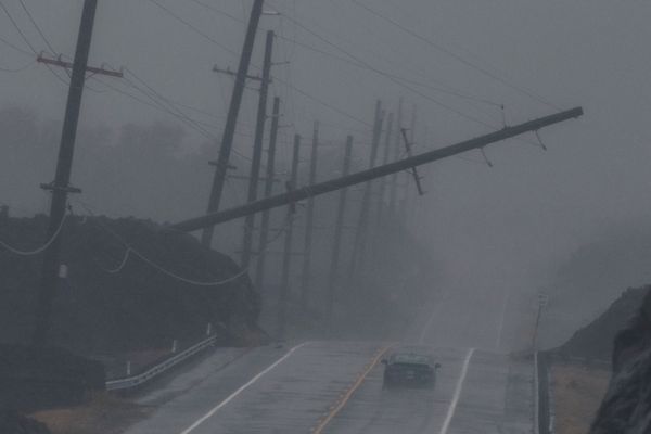
For the third time this year, Hawaii is under a hurricane watch—that’s never happened before. Hurricane Nolo, currently south of the Big Island, could mark the first time three storms have ever come within 50 miles of the archipelago in a single year. Both firsts are a marker of what an unprecedented hurricane season this has been for the state, brought about by an exceptionally strong El Niño and a dose of bad luck.
As of Friday morning, Nolo is about 200 miles south of the Big Island, moving slowly northward. Because of an area of high pressure developing to the island’s north, it is expected to take a sharp westward turn as a Category 3 storm on Saturday morning. Nolo’s exact track is uncertain, but the storm is expected to avoid a direct landfall. Nevertheless, it will once again bring torrential rains and devastating mudslides—parts of the Big Island could see 35 inches of rain. Many of the areas expected to see the heaviest downpours were already devastated by the 40 inches dumped by Hurricane Lala in August.
The other storm that brushed the islands this season was Hurricane Lowell, which struck Kauai and Niihau, the westernmost islands in the chain, in early September.
On supporting science journalism
If you're enjoying this article, consider supporting our award-winning journalism by subscribing. By purchasing a subscription you are helping to ensure the future of impactful stories about the discoveries and ideas shaping our world today.
Despite its tropical clime, Hawaii rarely sees tropical cyclones (the blanket term for tropical storms, hurricanes and typhoons). For one thing, the ocean waters around it are typically too cold to support the convection that fuels these storms. And any systems that do get close are often torn apart by wind shear, or winds blowing in different directions at different heights in the atmosphere.
But it can happen. And storms are more likely around Hawaii when there’s an El Niño—the cyclical climate event that shifts a pool of warm water in the equatorial Pacific Ocean eastward. That push alters where heat is released into the atmosphere, which causes a cascade of changes to prevailing wind patterns and weather around the world. It tends to lessen shear in the eastern Pacific, which makes the region a hotbed of hurricane activity, as it has been this year (meanwhile the Atlantic has been notably quiet).
But even a strong El Niño isn’t a guarantee that Hawaii will see storms—after all, it’s a small area of land in a vast ocean, so it’s not an easy target to hit. The hurricane season of 2015 was exceptionally active because of a strong El Niño, but it just happened that only one storm came particularly close to the islands.
For Hawaii, only a handful of years have seen multiple close calls with storms. Three hurricanes came within 100 miles of Hawaii in 1957 (another El Niño year), says Phil Klotzbach, citing National Oceanic and Atmospheric Administration data. Two hurricanes came within that distance in 1959, 2014 and 2016. Nolo is expected to stay about 150 miles south of the Big Island, but if the path changes and it ventures closer, 2026 would be only the second year three such storms have brushed so close to the islands.
Even more remarkably, if it came within 50 miles of the islands, it would be the third to do so this year, which has never happened before, wrote meteorologist Michael Lowry in a blog post. Only six hurricanes have ever come that close to the islands and none within the same year. “This amounts to three decades worth of hurricane threats to Hawaii in one year,” Lowry wrote. But even having had two come that close in one year is remarkable.