
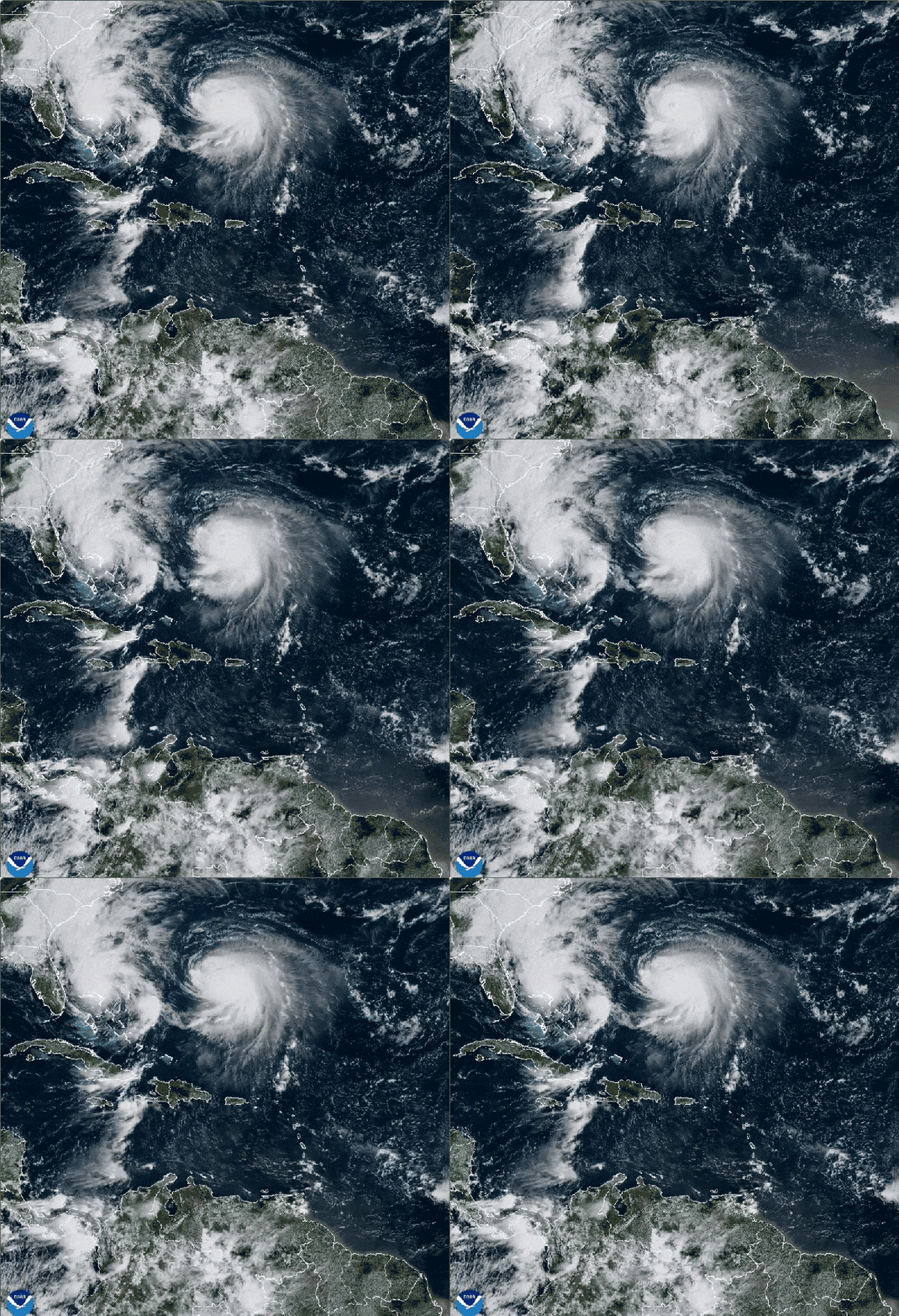
The U.S. Southeast will likely avoid the worst effects from Tropical Storm Imelda—all thanks to another tropical cyclone.
Imelda and Hurricane Humberto have been churning over the northeastern Caribbean, between the Bahamas and Bermuda, for several days. Last Friday the forecasts were highly uncertain about Imelda’s path and future strength: the possibilities ranged from the storm making landfall in the Carolinas, which would bring torrential rain and floods, to it not making landfall in the U.S. The latter now looks to be the likely scenario. That’s because Imelda dawdled in its development while Humberto quickly exploded into a major hurricane, which has influenced how much the two storms “feel” each other—essentially a flavor of what is called the Fujiwhara effect. (The East Coast will still feel rip currents from Imelda, though, and the storm could pose a threat to Bermuda as it takes a sharp eastward turn in the coming days.)
READ MORE: Hurricane Science Has a Lot of Jargon—Here’s What It All Means
On supporting science journalism
If you're enjoying this article, consider supporting our award-winning journalism by subscribing. By purchasing a subscription you are helping to ensure the future of impactful stories about the discoveries and ideas shaping our world today.
The higher-than-usual level of forecast uncertainty can be explained partly by the fact that storms in the Atlantic don’t typically form this close to each other. Tropical cyclones are influenced by the larger atmospheric environment, and adding another storm system makes that environment more complex. Meteorologists were also unclear about exactly where the center of Imelda would ultimately form, which made it difficult to know how that center would interact with other features in the atmosphere.
To get a sense of the atmospheric picture last Friday, it’s helpful to remember that the atmosphere is three-dimensional, with various low- or high-pressure areas or wind currents at various altitudes. In this case, there was a low-pressure area higher up in the atmosphere over the Southeast, an area of high pressure that is quasi-permanently centered roughly over Bermuda, and the two storms—Humberto and what would become Imelda, then called Potential Tropical Cyclone Nine. What wasn’t clear was whether Imelda would form quickly enough and in the right place for it to interact with that upper-level low, which would push it more rapidly north and toward a U.S. landfall. “Hurricanes are governed by the surrounding wind flow, and the quicker [the storm] gets stronger, the more it gets influenced by winds higher up in the atmosphere,” says Alan Gerard, a retired National Weather Service meteorologist, who runs the consulting company Balanced Weather.
But Imelda was very slow to become organized into a full tropical storm, so it has crept northward slowly, leaving it in the perfect spot to feel the pull of Humberto. “Essentially what happens is: you’ve got [westerly] winds around Humberto from the cyclone, and Imelda just gets caught up in that and follows behind,” Gerard says.*
This is a form of the Fujiwhara effect, says University of Miami hurricane researcher Brian McNoldy. In 1921 Japanese meteorologist Sakuhei Fujiwhara theorized that two vortices spinning through fluid (which is exactly what tropical cyclones are) could come close enough to each other to begin orbiting a common central point. If such storms move even closer, they can eventually merge into one, which happened with Hurricanes Hilary and Irwin in the eastern Pacific in 2017.
READ MORE: How to Decode a Hurricane Forecast
Imelda and Humberto aren’t close enough for that to happen, but the Fujiwhara effect can take other forms once the distance between two storms is within about 800 miles, and each can “feel” the other, McNoldy says. “The centers of Imelda and Humberto are now just 600 miles apart, and their outer circulations are already communicating,” McNoldy wrote in an e-mail to Scientific American. “Model forecasts bring them even closer together in the coming couple of days.”
Humberto is weakening the quasi-permanent ridge over Bermuda and opening up a path to pull Imelda behind it. Essentially, “Imelda is caught up in Humberto’s wake,” Gerard says.
Though this reduces the risks to the U.S., the interaction could mean that Imelda will pose more of a direct threat to Bermuda than Humberto will; the latter will travel a few hundred miles to the north of the islands.
*Editor’s Note (9/29/25): This sentence was edited after posting to correct Alan Gerard’s comment about westerly winds around Humberto.